Pothole Positioning System (PPS) - Enhancing Jamaica's Infrastructure
The Pothole Positioning System (PPS) is a community-driven mobile app designed to make reporting and tracking urban infrastructure issues across Jamaica easier than ever. From potholes and broken street lights to flooding and blocked drains, PPS empowers users to contribute to a safer, more organized community by reporting issues in real-time.
Key Features:
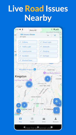
🗺️ Issue Mapping
1. Interactive map displaying all reported issues across Jamaica
2. Real-time location tracking for convenient issue reporting
3. Custom markers to indicate different types of issues like potholes, garbage, and traffic lights
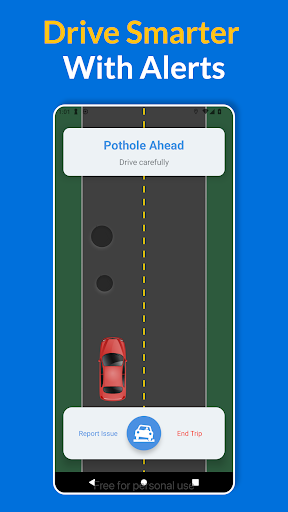
🚗 Driver Mode
1. Real-time pothole detection using your device’s accelerometer
2. Voice alerts for upcoming hazards while driving
3. Trip tracking with statistics and quick reporting options
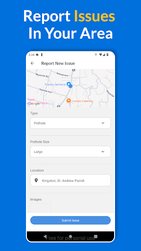
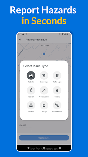
📝 Easy Issue Reporting
1.Multi-image upload for detailed issue documentation
2. Automatic location detection for precise reporting
3. Select from multiple issue types with a visual picker
4. Real-time submission updates to track the status of your report
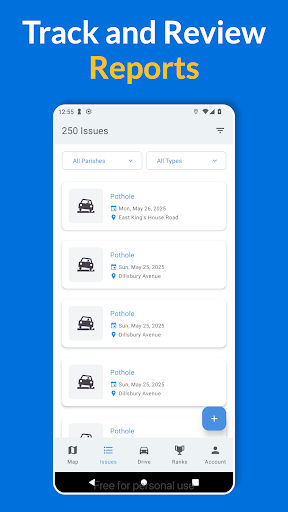
👤 Personalized User Experience
1. Track your reported issues with personal history
2. Secure login and data management
3. Customizable settings for location services, voice alerts, and user preferences
Help improve Jamaica’s infrastructure with PPS. Report, track, and monitor infrastructure issues, and make your community a better place for everyone!
Data safety
Safety starts with understanding how developers
collect and share your data. Data privacy and security practices may vary based
on your use, region, and age. The developer provided this information and may
update it over time.