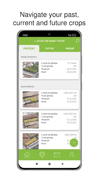
• View your declared holding
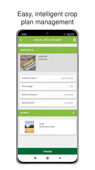
• Plan upcoming crops, its planting and harvest dates
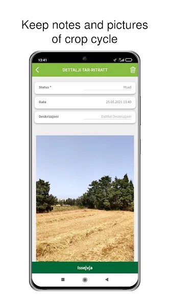
• Take geo-tagged photos of your crops
• Take geo-tagged photos of requested parcel as requested by ARPA
• Avoid non-conformities within the objectives of the CAP (Common Agricultural Policy)
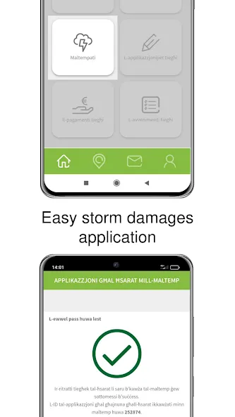
• Get ready in the eventuality of a storm or force majeure. You can use the geo-tagged photos of your
inventory before and after the storm and submit them with your request for financial aid
• Follow your payment claim
• Receive notifications
• Communicate directly with a representative
Download now and get started!
-------------------
Aċċess għal inventarju agrikolu kollu tiegħek.
Bil-BiedjaCam aġġornata int tista’
· Tara l-għelieqi kollha tiegħek
· Tippjana l-uċuħ tar-raba’ tiegħek, kemm it-tħawwil u kif ukoll il-ħsad tal-prodott
· Tieħu ritratti ġeo-lokalizzat tal-uċuħ tar-raba’
· Tieħu ritratti ġeo-lokalizzat tal-għelieqi fejn ikun rikjest mill-ARPA
· Tevita li jkollok nuqqas ta’ konformità fl-għanjiet fi ħdan il-PAK (Politika Agrikola Komuni)
· Tkun ippreparat għal maltempata jew forza maġġuri. Inti tista’ tieħu ritratti ġeo-lokalizzat tal-inventarju
tiegħek kemm qabel u kif ukoll wara xi maltempata, fejn imbagħad inti tkun tista’ tapplika għal għajnuna għalħsarat ikkawżati minn maltemp
· Isegwi il-pagamenti tiegħek
· Tirċievi notifikazzjonijiet
· Tikkomunika direttament ma reppreżentant
Niżżel l-app u ibda skopri!
Data safety
Safety starts with understanding how developers
collect and share your data. Data privacy and security practices may vary based
on your use, region, and age. The developer provided this information and may
update it over time.