Estonian Drone Map is the official UTM solution from Estonian Air Navigation Services. The application allows you to see the rules for flying in Estonia, plan your flights and coordinate them with the air navigation service provider, if necessary.
The current app version:
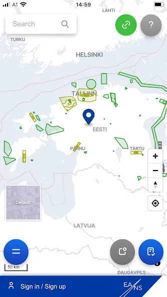
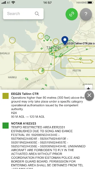
• Displays all the temporary and permanent restriction areas, including UAS geozones and NOTAM's
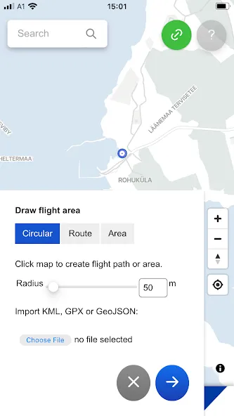
• Allows the pilot to plan their flights and submit flight plans (not mandatory for open category flights)
• Ask the ANSP for mandatory take-off clearance near helicopter pads and for specific category flights
Data safety
Safety starts with understanding how developers
collect and share your data. Data privacy and security practices may vary based
on your use, region, and age. The developer provided this information and may
update it over time.
Whats New
- Flight duration can't be set less then 30 mins
- Weather warnings and forecast in selected language
- Improved the search function in the Operator Map
- Improved zone display for future flight plans
- Improved drone name display