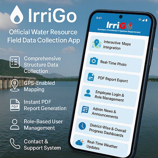
IrriGo – Official Water Resource Field Data Collection App
IrriGo is a professional mobile application designed to support field staff of water management authorities in accurately recording, monitoring, and managing key water resource structures. Built specifically for field engineers, irrigation officers, and administrative teams, IrriGo simplifies field data collection, real-time monitoring, and reporting for multiple irrigation infrastructure types.
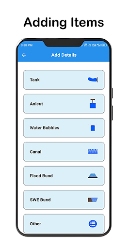
📊 Comprehensive Structure Data Collection
Record all types of water management structures:
• Tanks
• Anicuts
• Canals
• Water Bubbles
• Flood Bunds
• SWE Bunds
• Other Irrigation Structures
Each structure can be documented with full technical specifications, capacity, operational status, GPS coordinates, maintenance history, and attached photographs for accurate recordkeeping.
📍 GPS-Enabled Mapping
• Capture precise locations of every structure.
• Visualize all entries on interactive maps.
• Improve planning, field navigation, and resource allocation.
📄 Instant PDF Report Generation
• Generate professional reports directly from the app.
• Export data for administrative processing, audits, and reporting.
👷 Role-Based User Management
• Secure login using Firebase Authentication.
• Role-based permissions for admins, supervisors, and field officers.
• Ensure controlled access to sensitive data.
📰 Department News & Announcements
• Receive real-time department updates.
• Stay informed with official circulars, notices, and announcements.
🖼️ Photo Capture & Upload
• Take site photos or upload from gallery.
• Attach visual evidence directly to structural records.
📞 In-App Contact & Support
• Field officers can request support or clarification from headquarters.
• Built-in communication channel to streamline operations.
📊 District-Wise Progress Tracking
• Monitor structure reporting progress across multiple districts.
• View summary dashboards for real-time progress status.
🌦️ Live Weather Integration
• Display local weather conditions for safer field inspections.
• Help officers plan their field visits more effectively.
🔒 Highly Secure Platform
• All data stored securely in Google Firebase.
• Encrypted transmission ensures data privacy and protection.
________________________________________
✅ Main Modules Include:
• Structure Registration (All types)
• Interactive Google Maps Integration
• Photo Documentation
• PDF Report Export
• Employee Login & Role Management
• Admin News & Announcements
• District-Wise & Overall Progress Dashboards
• Real-Time Weather Updates
• Contact & Support System
________________________________________
Who Should Use IrriGo?
• Irrigation Department Field Staff
• Irrigation Engineers & Supervisors
• Water Resource Officers
• Government Administrative Teams
• Water Conservation Projects
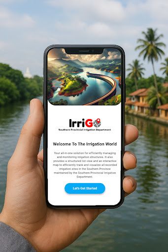
IrriGo is built to empower public sector irrigation departments, engineers, and administrative staff to accurately manage critical water resources, streamline reporting, and ensure long-term resource sustainability.
Data safety
Safety starts with understanding how developers
collect and share your data. Data privacy and security practices may vary based
on your use, region, and age. The developer provided this information and may
update it over time.