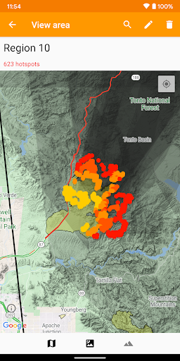
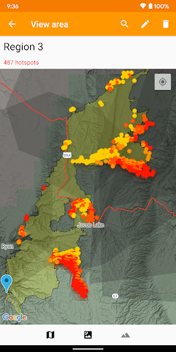
Get a powerful wildfire activity tracking map with fire alerts and near real-time tracking of fire locations and progression.
See details of fire activity overlaid on a single map:
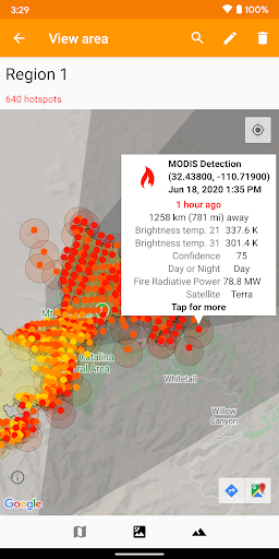
• Hotspots identified by satellite-based sensors
• US & Canada wildfire incident reports
• Wildfire burned area boundaries
• Crowdsourced fire report markers
• NOAA smoke areas
• Cal Fire incident detail
• Fire weather risk areas
• Fire cameras
Who can benefit from this app?
• Anyone living or working in wildfire-prone areas
• People who may want to alert family members in remote or high-risk areas
• Anyone interested in emergency preparedness and wildfire risk reduction
No login or registration required.
QUICK START: Open app and tap on "Fires near me"
Ad-supported. If you like the app, please consider upgrading with a one-time purchase to unlock bonus features, disable advertising, and support future development.
Data safety
Safety starts with understanding how developers
collect and share your data. Data privacy and security practices may vary based
on your use, region, and age. The developer provided this information and may
update it over time.