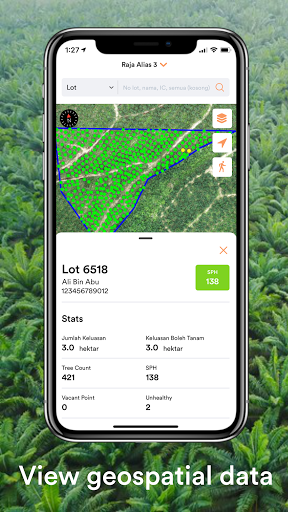
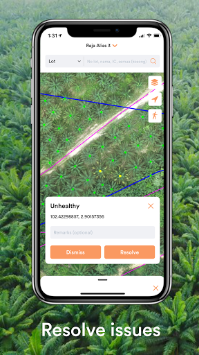
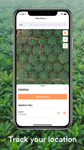
Interactive GIS tool for FELDA's plantation managers to efficiently manage their plantations. View tree points, vacant points and unhealthy points on top of a high-res orthomosaic map of plantations, search and filter through lots, resolve issues directly and download offline data for offline use.
Data safety
Safety starts with understanding how developers
collect and share your data. Data privacy and security practices may vary based
on your use, region, and age. The developer provided this information and may
update it over time.