About this App
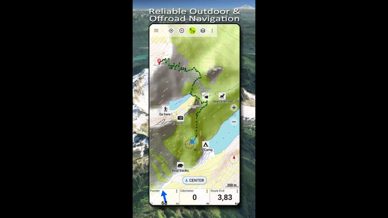
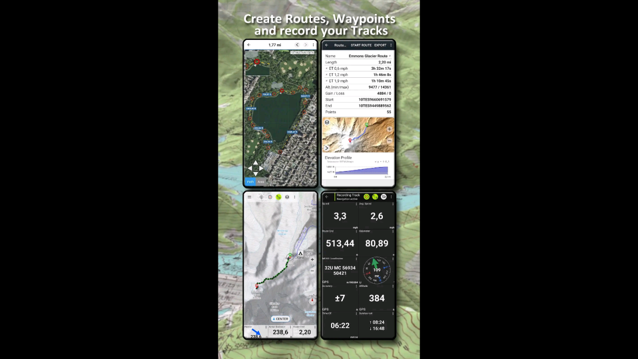
Offroad & Outdoor Navigation. Multiple Maps: Topo, Aerials, Nautical Charts, etc
Easy to use outdoor navigation app with free access to the best available maps and aerial imagery for Canada.
Choose between 30+ map layers (topos, aerials, sea charts, ...) to plan the perfect trip and
turn your Andoid Phone/Tablet into an outdoor GPS for offline trips into the backcountry.
*** Note: Please use Canada Base Map, Toporama or OpenStreetMap layer if you need most recent topo maps ! ***
Add easily maps from other sources (GeoPDF, GeoTiff, Online Map Services like WMS, ...)
Available base map layers for Canada:
• Topomaps Canada (CanMatrix, seamless coverage at scales 1:50.000 and 1:250.000), incl. USA 1:24.000 - 1:250.000), > 30.000 maps
• Canada Basemap CBMT (CanVec, NTDB, Atlas of Canada)
• Toporama Maps Canada in EN&FR (CanVec, NTDB, Atlas of Canada)
• CanTopo (new Canada Topos at 1:50.000, partial coverage of Canada, mainly in the North)
• Ontario LIO Topo Maps
• Québec Topo Maps 1:20.000
• Saskatchewan Orthophotos
• Nova Scotia Othophotos
• British Columbia Topo Maps
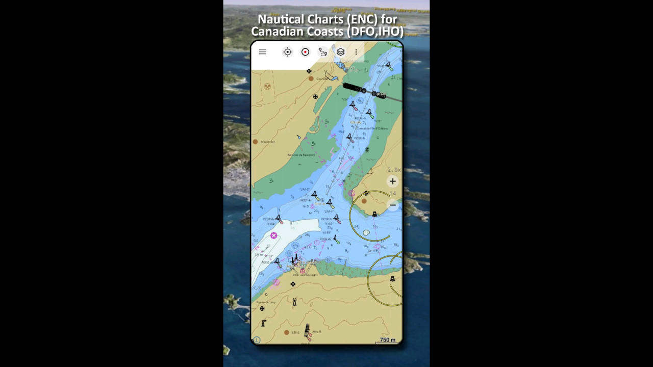
• Nautical Charts ENC
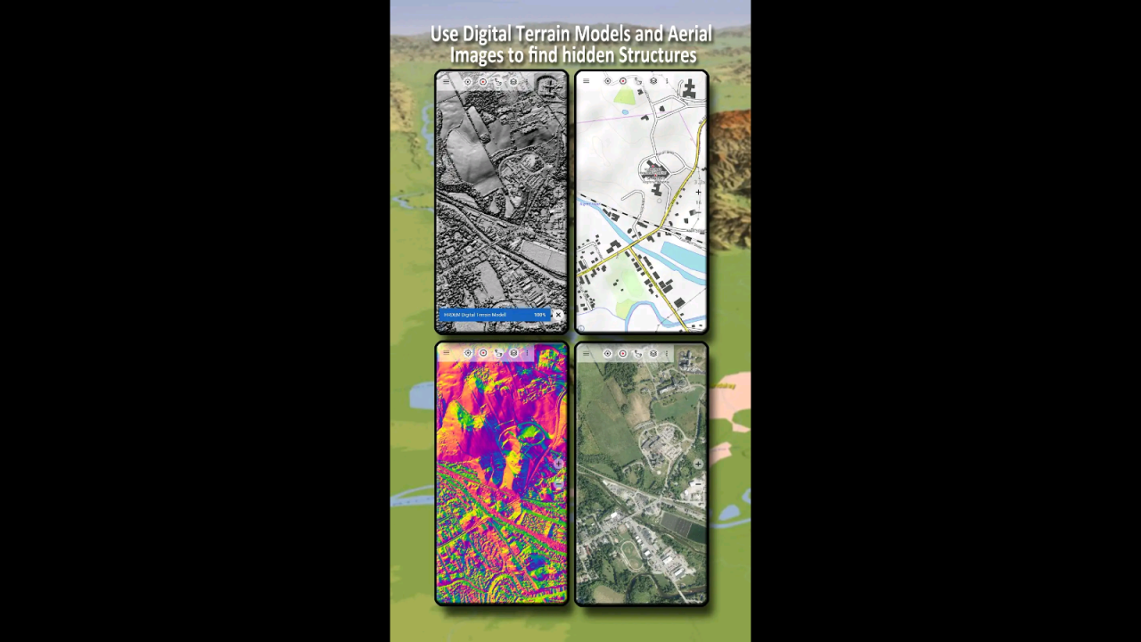
• Digital Elevation Model
• HRDEM (HiRes Elevation Model, parts of Canada)
Worldwide basemap layers:
• OpenStreetMaps (5 different map layouts), also downloadable in space saving vectorformat
• Google Maps (Satellite images, Road- and Terrain-Map)
• Bing Maps (Satellite images, Road-Map)
• Waze Roads
• Earth At Night
Configure a basemap layer as an overlay and utilize a transparency fader to seamlessly compare maps with each other.
Add maps from other sources:
• Import raster maps in GeoPDF, GeoTiff, MBTiles or Ozi (Oziexplorer OZF2 & OZF3)
• Add web mapping services as WMS or WMTS/Tileserver
• Import OpenStreetMaps in Vectorformat, eg complete USA for just some GBs
Available Canada map Overlays - add additional information to any other base map:
• CanVec features such as Transportation, Contourlines, Hydronetwork, Toponymic Features, etc.
• Nova Scotia Roads
• Yukon Transportation
Available worldwide overlays:
• Hillshad