Designed and tested on real dirt, Topo Maps+ is packed with the maps & tools to plan and execute your backcountry adventure.
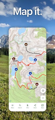
‣‣ MAPS FOR EVERY ACTIVITY
‣Setup your map based on your planned activity
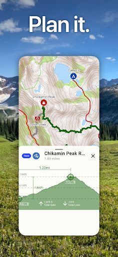
‣‣ PLANNING TOOLS
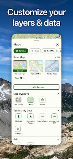
‣ Compare and Download maps for use offline.
‣ Combine overlays to customize your map view
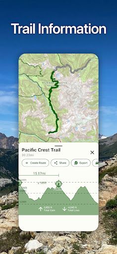
‣ Smart route-building tools
‣ Waypoints
‣ Print, email or share custom maps and route
‣ Create teams and share data
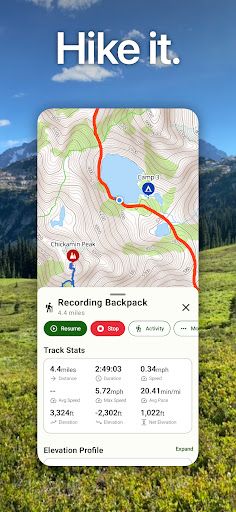
‣‣ ON-TRAIL TOOLS (Offline)
‣ View your current location
‣ All Maps and Overlays are downloadable
‣ Record your tracks - see where you’ve been
‣ Downloaded elevation data for route-creation on the trail
Data safety
Safety starts with understanding how developers
collect and share your data. Data privacy and security practices may vary based
on your use, region, and age. The developer provided this information and may
update it over time.
Whats New
- Fixed a crash during startup.
- Fixed an issue with uploading diagnostics.